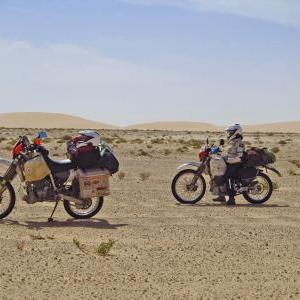
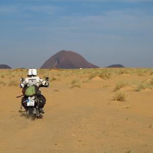
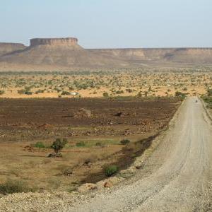
This is the off-road route (piste) R2, as described by Chris Scott in his book "Sahara Overland". It doesn't have to be followed precisely but the purpose of the route is to indicate where the sand is better for riding. There are other areas with very soft sand where riding is a nightmare. This route is not difficult for a proper off-road bike and it's possible even on dual sport (on-off) bikes, if they are not too heavily loaded.
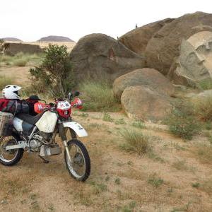
The route follows the railway more or less and it's quite a sight to see one of the world's longest trains crossing the Sahara! If you are travelling solo, I would say that this route is the safest to ride in the desert because of its proximity to the railway. Another amazing sight is Ben Amira rock, reputedly the second largest monolith in the world! The nearby sculptures are interesting too and it's an eerie place to wild camp. If you want to spend the night there, go straight there without passing through Ben Amira village, because the policemen will not let you camp anywhere else except in front of the police station!
You can find spring water in small settlements and villages along the route. It's quite clean and we never had an issue with that. Locals are friendly and helpful. Make sure you got enough fuel for 600 km in the sand! Usually, there is smuggled petrol in Choum (and it's cheaper there) but it's not guaranteed.
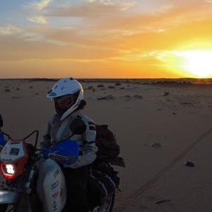
I would say you need two full days to make it, except if you're racing. We did it in three days and we really enjoyed it!
Mauritania: Sahara off-road piste (R2)!

Track comments

-
Start of track"2013-11-07 13:31:56 Auto"
Bir Gandus, caïdat de Bir Gandouz, cercle de Bir Gandouz, Province d'Aousserd إقليم أوسرد, Dakhla-Oued Ed-Dahab, Morocco -
You can find water here!
Nouadhibou, Dakhlet Nouadhibou, Mauritania -
Finish of track"2013-11-07 13:31:56 Auto"
Boulenouar, Dakhlet Nouadhibou, Mauritania -
Start of track"2013-11-08 09:36:39 Auto"
Boulenouar, Dakhlet Nouadhibou, Mauritania -
old (2008) Boulenouar - Choum track, Dakhlet Nouadhibou, Mauritania -
Finish of track"2013-11-08 09:36:39 Auto"
أم غريدات, Dakhlet Nouadhibou, Mauritania -
old (2008) Boulenouar - Choum track, Dakhlet Nouadhibou, Mauritania -
أم غريدات, Dakhlet Nouadhibou, Mauritania -
أم غريدات, Dakhlet Nouadhibou, Mauritania -
Start of track"2013-11-09 11:28:54 Auto"
أم غريدات, Dakhlet Nouadhibou, Mauritania -
Finish of track"2013-11-09 11:28:54 Auto"
(Tmeimichat) اتميمشات, Adrar, Mauritania -
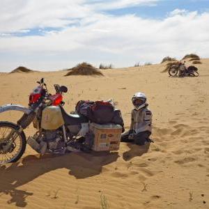
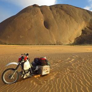
Azeffal Dunes start from here to the East until the next waypoint. It's about 60 km (37 miles) on low dunes. It's not a difficult crossing. Just reduce the air pressure in the tyres and maintain some speed.
old (2008) Boulenouar - Choum track, Adrar, Mauritania -
old (2008) Boulenouar - Choum track, Adrar, Mauritania -
(Tmeimichat) اتميمشات, Adrar, Mauritania -
Adrar, Mauritania -
Adrar, Mauritania -
Start of track"2013-11-10 09:44:42 Auto"
(Tmeimichat) اتميمشات, Adrar, Mauritania -
Finish of track"2013-11-10 09:44:42 Auto"
Atar, Adrar, Mauritania -
Atar, Adrar, Mauritania

- Adrar, Mauritania
- Atar, Adrar, Mauritania
- RN1, Adrar, Mauritania
- Nouadhibou, Dakhlet Nouadhibou, Mauritania
- old (2008) Boulenouar - Choum track, Dakhlet Nouadhibou, Mauritania
- old (2008) Boulenouar - Choum track, Adrar, Mauritania
- RN1, Adrar, Mauritania
- old (2008) Boulenouar - Choum track, Adrar, Mauritania
- old (2008) Boulenouar - Choum track, Adrar, Mauritania
- old (2008) Boulenouar - Choum track, Adrar, Mauritania
- Nouadhibou, Dakhlet Nouadhibou, Mauritania
- Atar, Adrar, Mauritania
- Nouadhibou, Dakhlet Nouadhibou, Mauritania
- أم غريدات, Dakhlet Nouadhibou, Mauritania