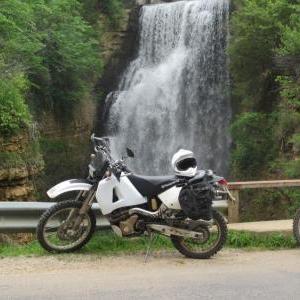
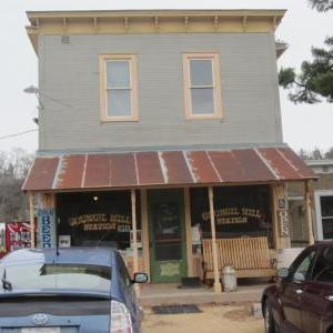
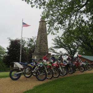
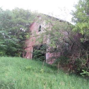
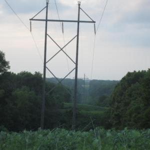
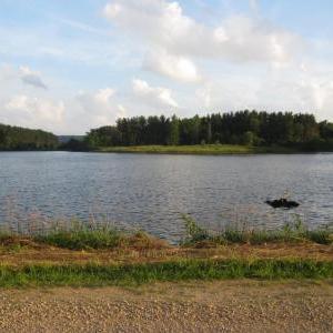
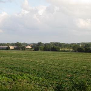
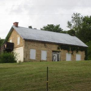
This is a track that I created for our club's annual dual sport trek. Total mileage for the loop is 165 miles and is best ridden counter clockwise. You can start at the gas station in Mount Carroll at the intersection of Route 64/52 and Mill Street. The staff there has been very cool about parking at the north end if you wish to truck/trailer your bike to town. Best to check with them first though. The track consists of many twisty blacktops, elevation changes, gravel and dirt roads. It is more fun on a thumper but a big adventure bike could handle it with maybe two go arounds depending on the weather. The infamous County Divide road is utilized and I have yet to traverse it on a wet day without being slammed to the ground. In the same exact spot I might add. Along the way you will see; The Blackhawk Battle Field Monument, quaint countryside farms, the spillway at Apple Canyon Lake, Council Hill Station, old churches, swanky houses, warm towns, the Mississippi River, an abandoned rail tunnel, floral, fauna, rural oddities, a ride through a golf course and lakes in the middle of nowhere. Elizabeth has gas and several food options for lunch. Council Hill Station has a limited menu but food is available. It's more of a stop for the vast selection of imported beer and a chat with owners Jaime and Diane. On the right day there also will be music and a barn dance. Yee-ha. Please respect private property, be aware of all traffic and of course the laws pertaining to said traffic and property. Nuff' said. If your fuel range is under 100 miles best to fill somewhere in Galena just to be sure you make it back to Mount Carroll. Track updated November 2015 to re-route a road closure. As always, ride safely and enjoy.
This track, photos and description originaly posted at advrider.com forum by Gerken. Before riding this track I recommend to check forum topic for any updates or road blocks.
North Illinois dualsport track
Distance
263.15 km
Uploaded
7 years ago
Updated
7 years ago
Gravel
Offroad
Inclines
Water
Track comments

-
Start of track"CHADV1"
Mount Carroll, Carroll County, Illinois, 61053, United States of America -
Finish of track"CHADV1"
Jo Daviess County, Illinois, United States of America -
Start of track"CHADV2"
Jo Daviess County, Illinois, United States of America -
Finish of track"CHADV2"
Council Hill, Jo Daviess County, Illinois, United States of America -
Start of track"CHADV3"
Council Hill, Jo Daviess County, Illinois, United States of America -
Finish of track"CHADV3"
Blanding, Jo Daviess County, Illinois, United States of America -
Start of track"CHADV4"
Blanding, Jo Daviess County, Illinois, United States of America -
Finish of track"CHADV4"
Mount Carroll, Carroll County, Illinois, 61053, United States of America -
Start of track"PRIVATEDevlopment"
Polsgrove, Carroll County, Illinois, United States of America -
Finish of track"PRIVATEDevlopment"
Polsgrove, Carroll County, Illinois, United States of America
- Chicago, Central & Pacific Council Hill, Jo Daviess County, Illinois, United States of America
-
1883 S Snipehollow Rd
Elizabeth, IL, 61028, USA Schapville, Jo Daviess County, Illinois, United States of America -
10488 S Skunk Hollow Rd
Mt Carroll, IL, 61053, USA Loran, Stephenson County, Illinois, United States of America -
9033 S Town Hall Rd
Stockton, IL, 61085, USA Willow, Jo Daviess County, Illinois, United States of America - Blackhawk Battlefield Park Kent, Stephenson County, Illinois, 61044, United States of America
- Old Blanding Tavern & Campground Blanding, Jo Daviess County, Illinois, United States of America
- Schapville, Jo Daviess County, Illinois, United States of America
- Council Hill, Jo Daviess County, Illinois, United States of America
- Council Hill, Jo Daviess County, Illinois, United States of America
- Council Hill, Jo Daviess County, Illinois, United States of America
-
Emerald Acres Campground
3351 S Mill Grove Rd
Pearl City, IL, 61062, USA
815-443-2550 Bolton, Stephenson County, Illinois, United States of America -
11335 S Skunk Hollow Rd
Mt Carroll, IL, 61053, USA Loran, Stephenson County, Illinois, United States of America - 257 N Main St Elizabeth, Jo Daviess County, Illinois, United States of America
- 08-JUL-07 5:50:50PM Hanover, Jo Daviess County, Illinois, United States of America
-
9934 W US Highway 20
Galena, IL, 61036, USA Galena, Jo Daviess County, Illinois, United States of America - 884 S Mill St Mount Carroll, Carroll County, Illinois, 61053, United States of America
- Savanna Savanna, Carroll County, Illinois, 61074, United States of America
- Burlington Northern Blanding, Jo Daviess County, Illinois, United States of America
-
3503 S River Rd
Galena, IL, 61036, USA Aiken, Jo Daviess County, Illinois, United States of America - N Galena St and W State St Mount Carroll, Carroll County, Illinois, 61053, United States of America
- Quarter Moon Saloon Elizabeth, Jo Daviess County, Illinois, United States of America
- Chicago, Central & Pacific Council Hill, Jo Daviess County, Illinois, United States of America
-
2471 W Long Hollow Rd
Elizabeth, IL, 61028, USA Rodden, Jo Daviess County, Illinois, United States of America - Murphy USA Galena, Jo Daviess County, Illinois, United States of America
- 14-AUG-11 3:38:40PM Green Island, Jackson County, Iowa, United States of America
- Mount Carroll, Carroll County, Illinois, 61053, United States of America
- Bolton, Stephenson County, Illinois, United States of America
- W Kempel Rd and S County Divide Rd Kent, Stephenson County, Illinois, 61044, United States of America
- 499 N Carroll St Mount Carroll, Carroll County, Illinois, 61053, United States of America
- Sharks Roadhouse Elizabeth, Jo Daviess County, Illinois, United States of America
-
6145 W Kelly Rd
Scales Moun Council Hill, Jo Daviess County, Illinois, United States of America - Welcome Inn Elizabeth, Jo Daviess County, Illinois, United States of America
- 9861 S Whitton Rd Whitton, Jo Daviess County, Illinois, 61041, United States of America
-
2875 S Blackjack Rd
Galena, IL, 61036, USA Hanover, Jo Daviess County, Illinois, United States of America - Bolton, Stephenson County, Illinois, United States of America