Starting and end point is at the campground in Tenda (F). Heading north to the Colle di Tenda where you enter the Via del Sale in one of the first hairpins.
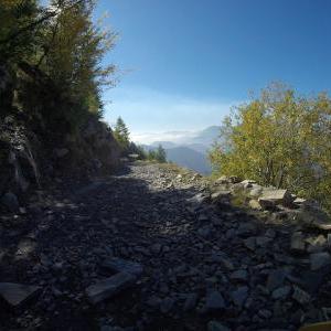
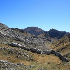
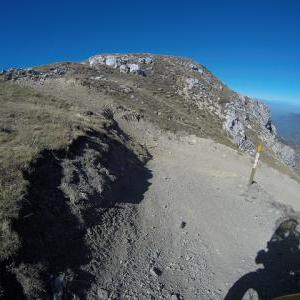
To enter the via del sale, you have to pay a road charge near the Fort Central. There are a few more options to enter the road and pay the road charge, but this is, i think , the most famous way. Most of the time, you are at about 2000m altitude and will have a stunning view all around.
In 10/2017 there was a mudslide on the mainroad at the beginning, so they bypass the road on a hiking trail. So, this part is NOT for cars at the moment. The road conditions differ, but are always no big problem in dry conditions. Sometimes, its a little bit rocky and in wet conditions it may be very slippery.
Beside the road, there are some old forts build in the late 19th century.
https://de.wikipedia.org/wiki/Ligurische_Grenzkammstra%C3%9Fe
https://de.wikipedia.org/wiki/Colle_di_Tenda
The whole via del sale is longer, there is another southern part which ends nearly at the mediterrenean sea.
Via del Sale, northern part (IT/EN) / Route du Marguareis (F) / Ligurische Grenzkammstrasse Nord (DE)
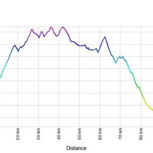
Distance
97.40 km
Uploaded
7 years ago
Updated
7 years ago

Alps France Italy Tenda Colle di tenda Col de tende Cuneo La brigue Fort central Fort tabourde Altitude 2000m Route du Marguareis Via del sale LGKS Ligurische Grenzkammstrasse Military road